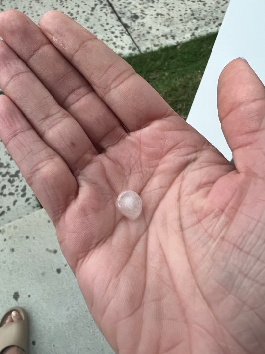
Classic summer warmth and humidity left each afternoon this weekend with some scattered downpours. Sunday’s round left a few spots around town flooded and even dropped some hail!
But the summer thunder and lightning was just a precursor to what could potential unfold Monday evening – an approaching cool front will crash into some hot and humid air, kick starting a round of scattered thunderstorms Monday evening and Monday night.
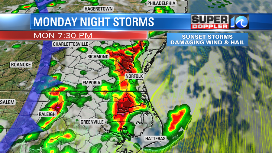
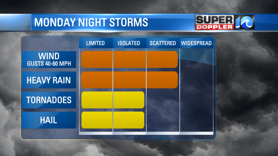
These storms have the potential to be strong and severe as the region is under a level three risk for severe weather (3 out of 5). We’ll look for scattered heavy rain, scattered damaging wind gusts, isolated hail and even an isolated tornadic threat.
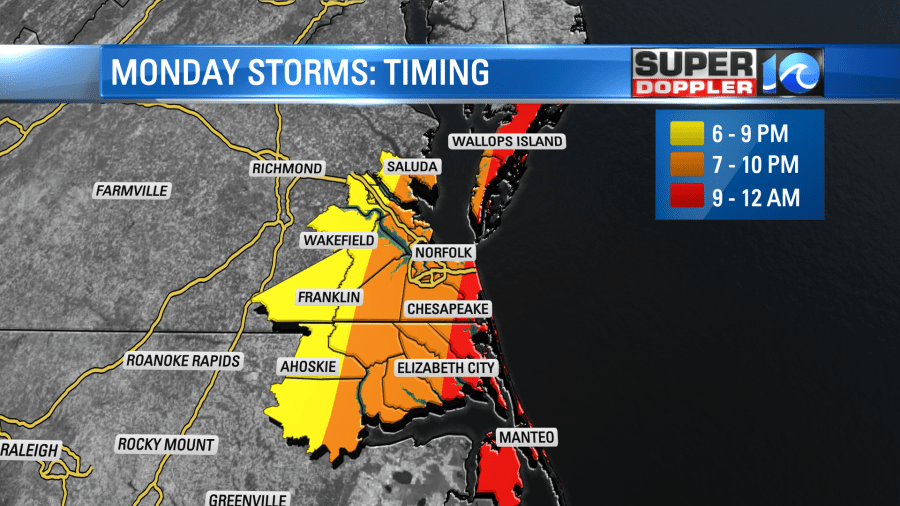
The timing has most of the rain moving into the region around sunset – but that Monday evening commute will be close. Think of a main storm window between about 6:00 and 11:00 in the evening.
One of the main reasons our risk for strong thunderstorms is elevated is the heat. High temperatures under the sunshine will easily reach the low 90s, and with the humidity as high as it will be, the afternoon will feel closer to the mid and upper 90s. Something we haven’t felt it awhile, so take frequent breaks if you’re outside and stay hydrated!
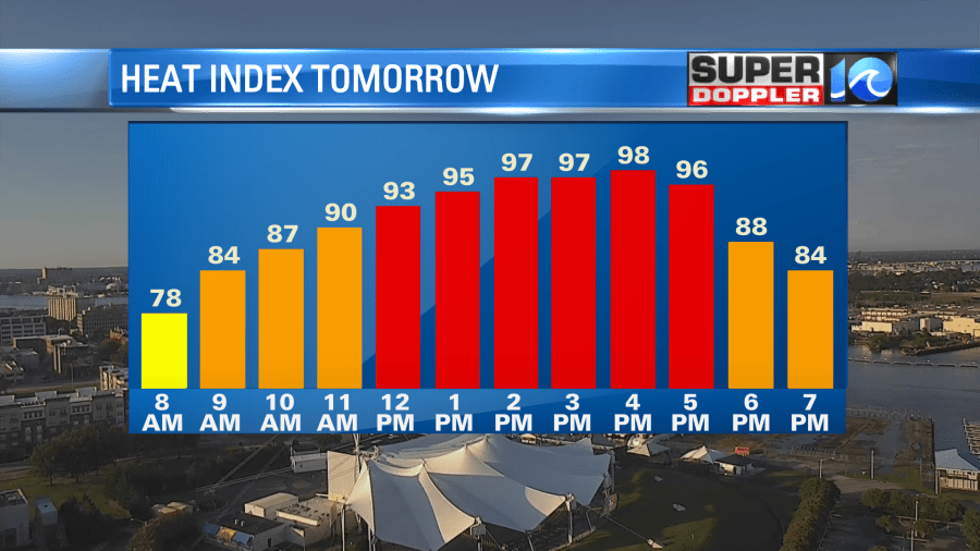
Fortunately, our daylight hours will be dry. There’s only a chance of a few pop-up showers or downpours before the main event rolls in by the evening.
Tuesday will be very similar to what we experienced over Saturday and Sunday – warm and humid with scattered showers and downpours by the afternoon. Drier weather moves in by the mid to late week time frame.
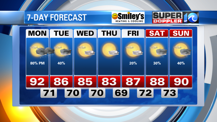
Tropically speaking, Tropical Storm Cindy will weaken as it struggles to crawl north in the western Atlantic. No concerns here at home, maybe an increased risk of rip currents by the end of the week.
For now, we’ll focus on the thunderstorm threat Monday night.
Meteorologist Steve Fundaro
