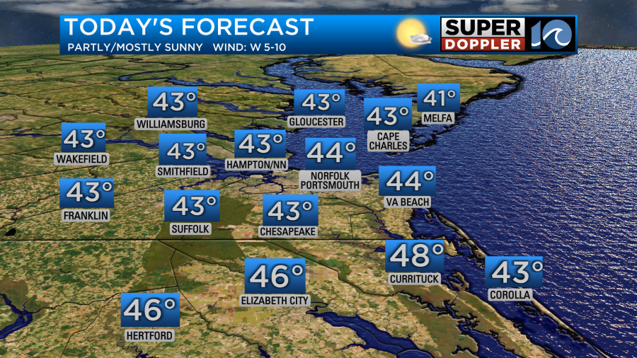
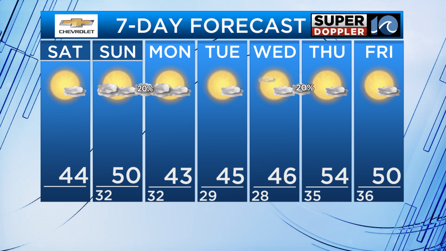
A very chilly start Saturday leads to a chilly afternoon as well, with highs Saturday only climbing into the low to mid 40s.
For our weekend we will see dry weather with mostly sunny skies. A few clouds move in Saturday night into Sunday morning, but we’ll see mostly sunny skies return for the afternoon. As we go into Sunday Night/Monday morning a weak disturbance will push in from the west giving us a slight chance for a rain/snow mix. Best chance across the Eastern Shore of VA/MD. No need to worry, we won’t see cold enough temperatures for icy roads or accumulation.
Cold temperatures continue into the work week, with highs in the 40s for Monday and Tuesday. Lows in the upper 20s to low 30s across the region. A slight warm up will occur Thursday into Friday, with highs back into the 50s.
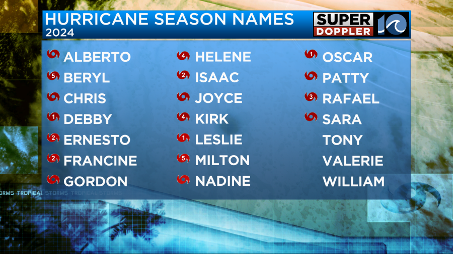
The 2024 Hurricane Season ends today! No storms are expected to develop in the Atlantic in the next 7 days. We saw a very active season, with 18 named storms.
Hope you have a great weekend!
Meteorologist Ricky Matthews
Follow Ricky on Facebook and Twitter