Before I get into the weather I want to talk about something interesting that happened this morning due to the wind. It’s something that I either don’t remember or have never seen before. At least not to this level. I pulled up the camera at Lynnhaven Inlet this morning, and this is what it looked like:
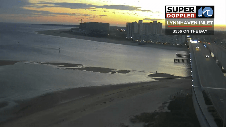
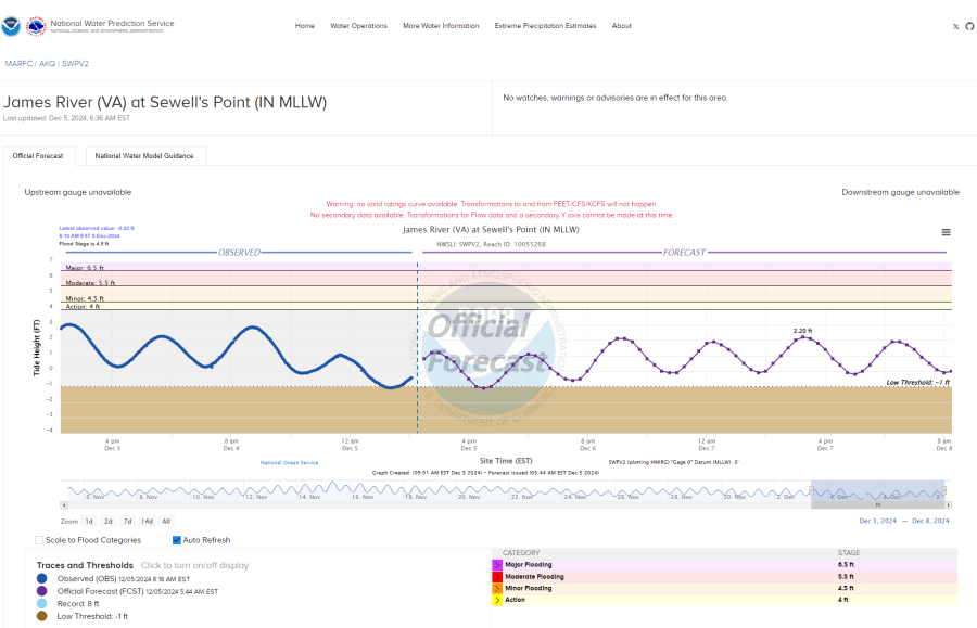
Those dark spots are land. The strong southwest wind helped to push the tide out a little extra. The level was a foot below 0 MLLW at Sewell’s Point.
This was during low tide. The wind was the main driver, but the current drought probably also contributed a little. Very interesting.
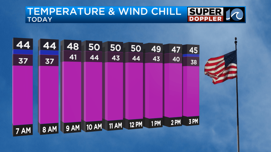
Anyway, those same southwest winds overnight kept the temperatures up. In fact, they increased a bit into the morning. So temperatures actually started in the mid 40s. That’s close to the high temps over the last couple of days. Gusts were up to 20-30mph with some higher gusts on the Eastern Shore. Those winds will stay up out of the southwest until about 11am. Then winds will turn out of the northwest, and they will increase.
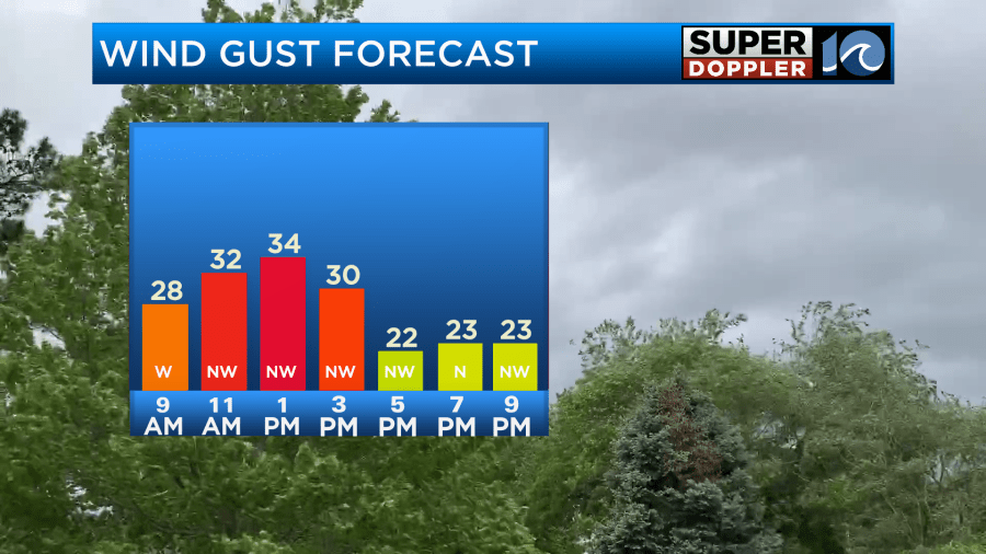
Winds will gust up to 35mph today at the peak. There may be a few gusts to 45mph near the shore.
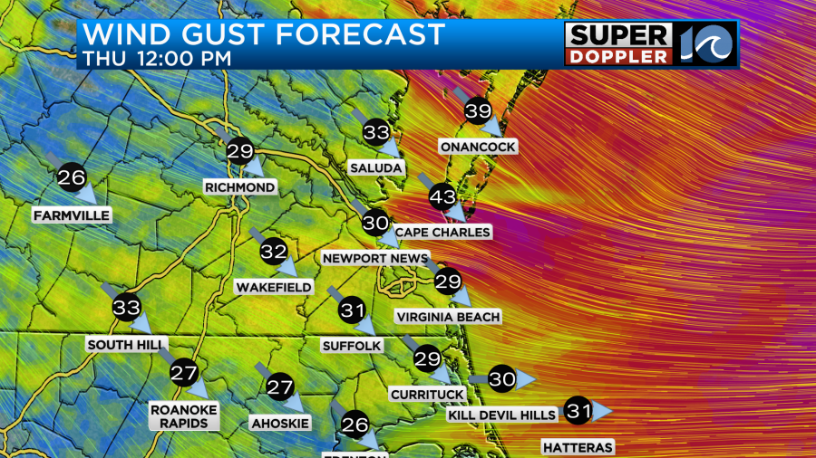
This has prompted Wind Advisories to be posted for areas along the coast.

This will create some nuisance to minor tidal flooding on the Bay-side of the Eastern Shore and the Sound-side of the Outer Banks during high tide.
The cold front will move through during the late morning.
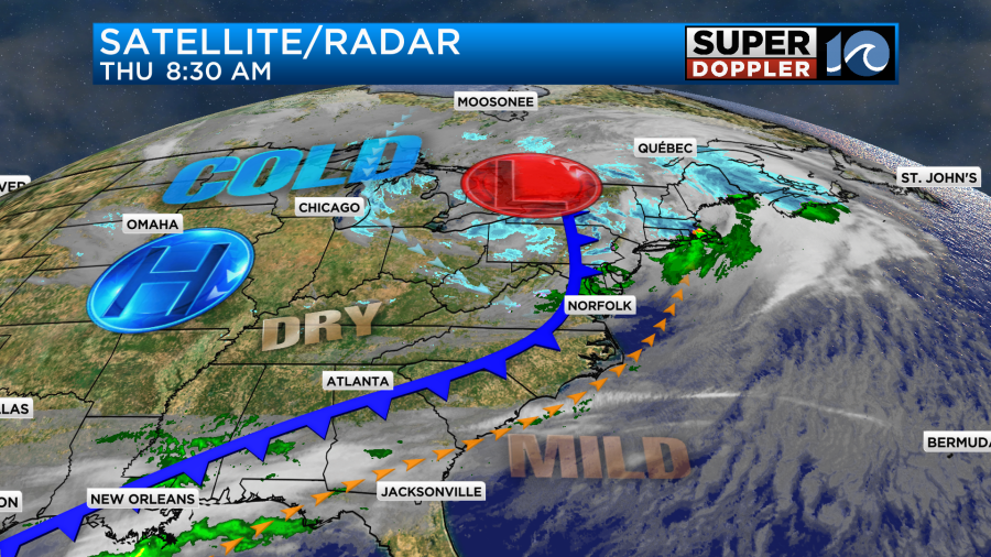
There may be some brief/isolated rain showers, but the air at the surface is very dry. So I doubt there will be much. Temperatures will rise to the low 50s during the late morning and midday hours. Then they will drop back to the low-mid 40s as we go through the afternoon.
Wind chills will drop to the 20s and 30s.
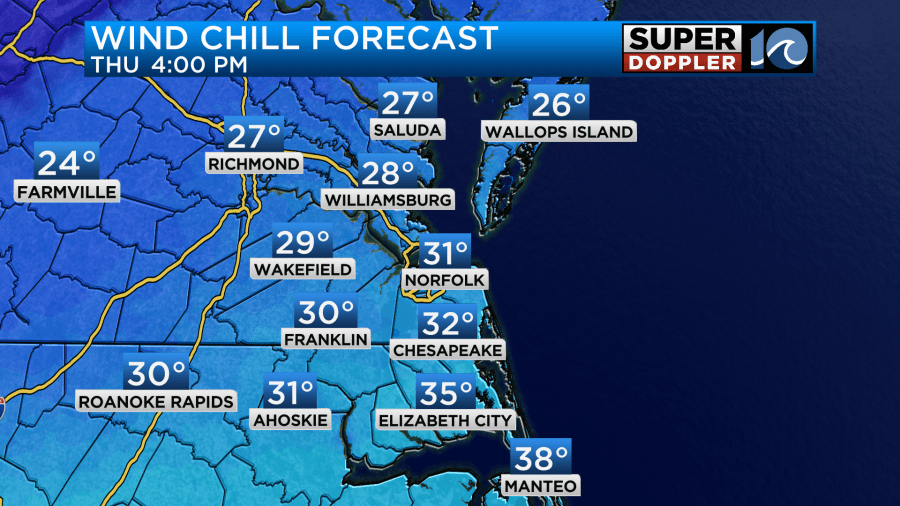
Tonight the winds will decrease a little, but not enough. Temps will fall to the 20s under mostly clear skies. However, the wind chills will drop to the teens area-wide.
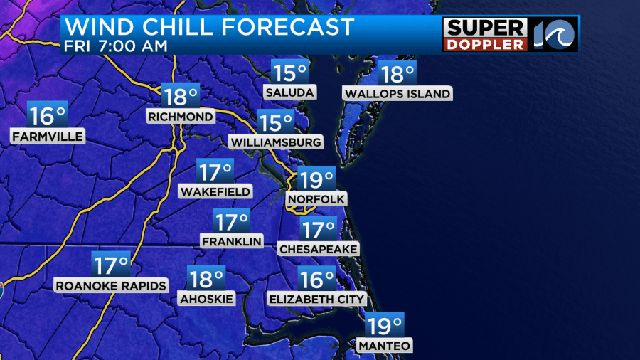
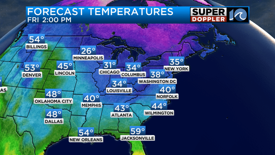
This will continue into Friday morning. That will be rough at the bus stops for the kids. It will be rough for folks that work outside too. So if you still haven’t pulled out the Winter gear yet, then I recommend you do it now. We’ll have a lot of sunshine tomorrow, but there will still be wind gusts to 20mph out of the northwest. That means that high temps will only make it to near 40 degrees.
It will be cold/chilly again on Saturday, but there will be less wind. Low temps will be in the teens and 20s. High temps will be in the mid 40s.
We’ll warm up nicely on Sunday. High temps will be in the mid 50s. It should be a pretty nice day. Then we’ll warm up to the 60s early next week. There will be a few showers though on Monday. Then we’ll have scattered rain showers Tuesday and Wednesday.
Be sure to lock down your holiday decorations if you haven’t already. Slow-drip the faucets tonight and tomorrow night. Try to stay warm.
Meteorologist: Jeremy Wheeler