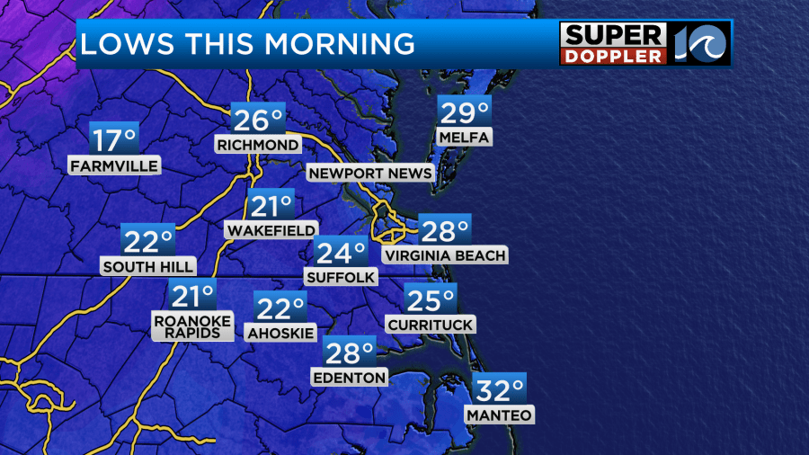
This morning we had a frigid start to the day. Temps were in the 20s mostly, but wind chills were in the teens and 20s.
Today it will be a struggle to warm up. We will lots of sunshine, but the wind will pick up out of the northwest. There will be some gusts to 20mph. That will keep the high temps around 40 degrees this afternoon.
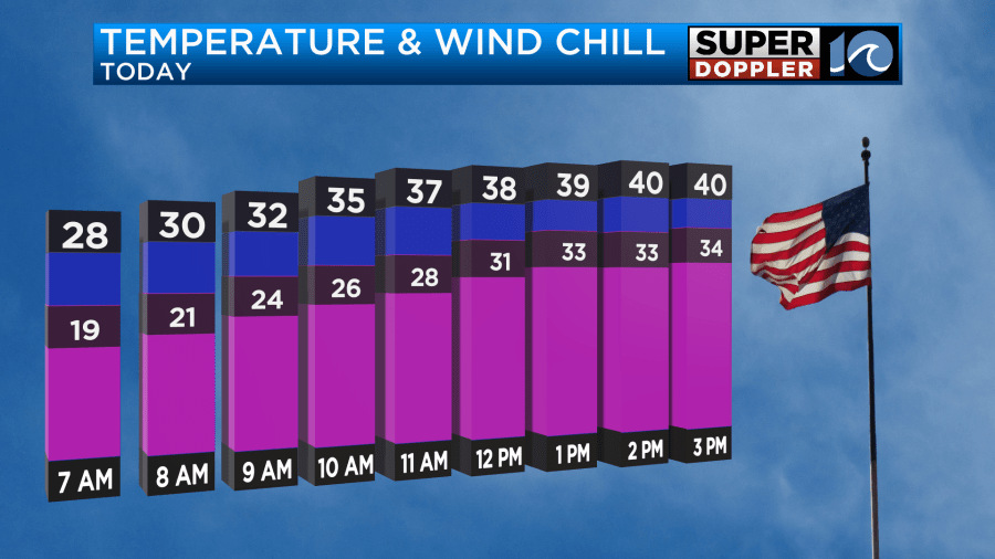
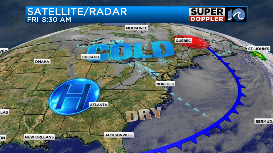
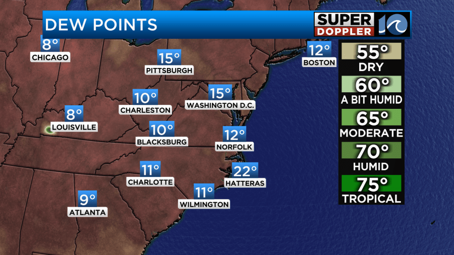
Wind chills will be in the 20s and 30s through the day. It is super dry outside. Dew points are in the teens and single digits.
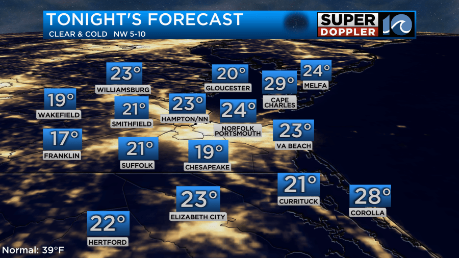
Tonight we’ll have clear skies and light winds. With the dry air combination temps are going to drop down to the mid 20s with lots of teens inland.
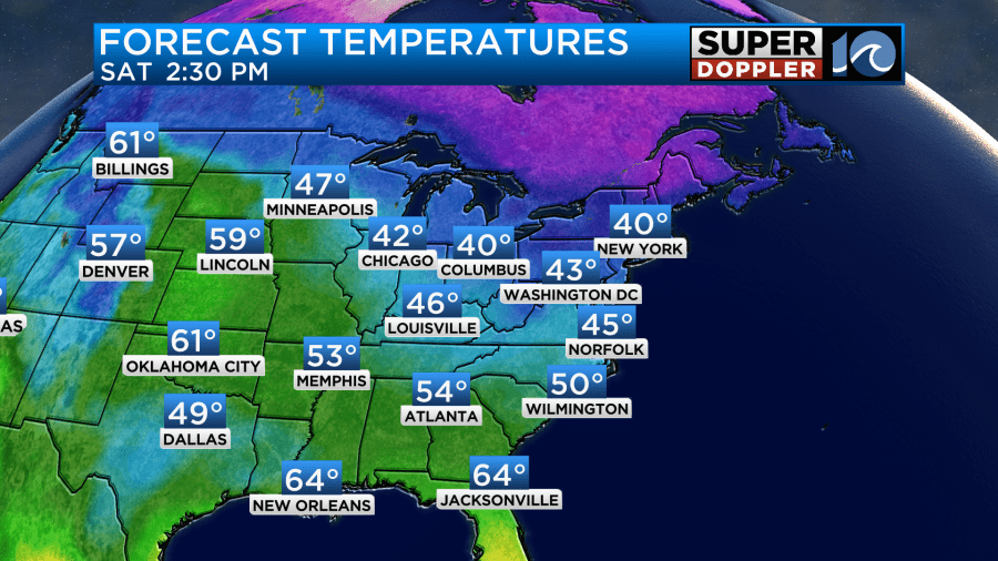
It will be a good night to slow-drip the faucets. You don’t need much. A very slow-drip will do. It’s mostly to relieve the pressure more than anything in case ice builds up in the pipe. Tomorrow we’ll have lots of sun but less wind. So high temps will make it into the mid 40s.
By Sunday we’ll still have dry air and high pressure, but the wind will pick up out of the southwest. This will boost the temperatures up into the upper 50s to near 60.
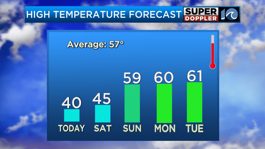
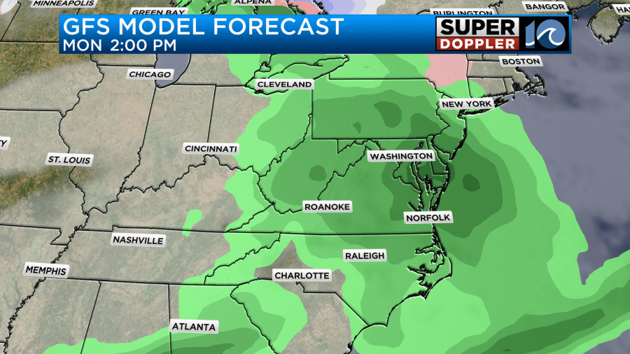
We’ll stay milder next week with high temps in the 60s until Thursday. Then temps will fall to near 50 degrees. There will be some rain next week. It’s looking pretty wet on Monday now with more rain possible Tuesday into Wednesday.
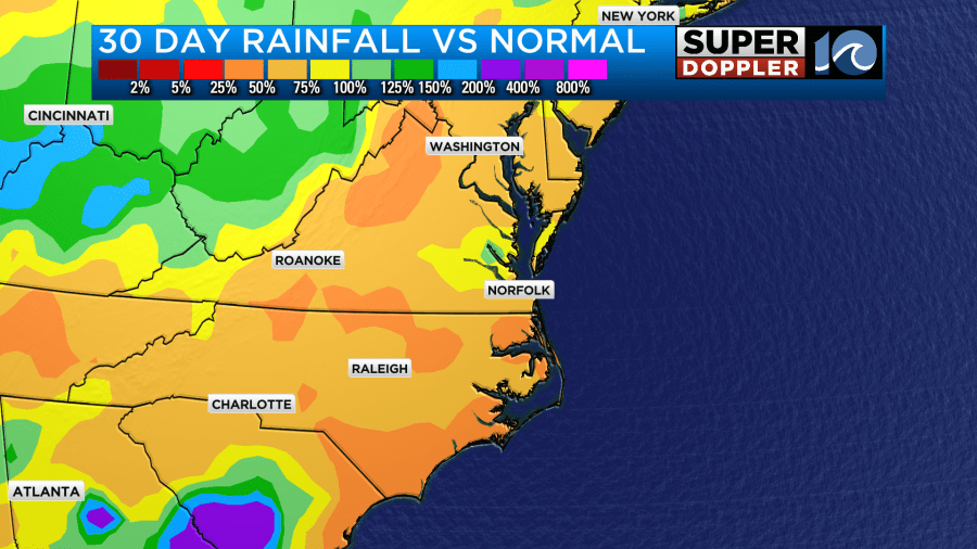
We do need the rain. We’ve had about half as much rain compared to average for the last 30 days.
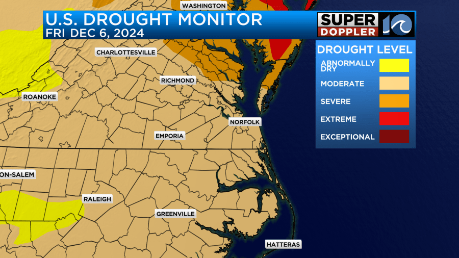
Most of the region is in a moderate drought with severe drought north and northeast of the metro.
So hopefully, we’ll get some rainfall next week. It shouldn’t rain the whole time. We should have some time to get outside and enjoy the milder temps.
Meteorologist: Jeremy Wheeler