We just had some great weather on Sunday! Temperatures finally warmed up to the 60s, and we had a lot of sunshine. Today will still be fairly mild. However, the moisture is increasing big-time. There is a warm front to our north with 2 strong cold fronts developing over the Midwest.
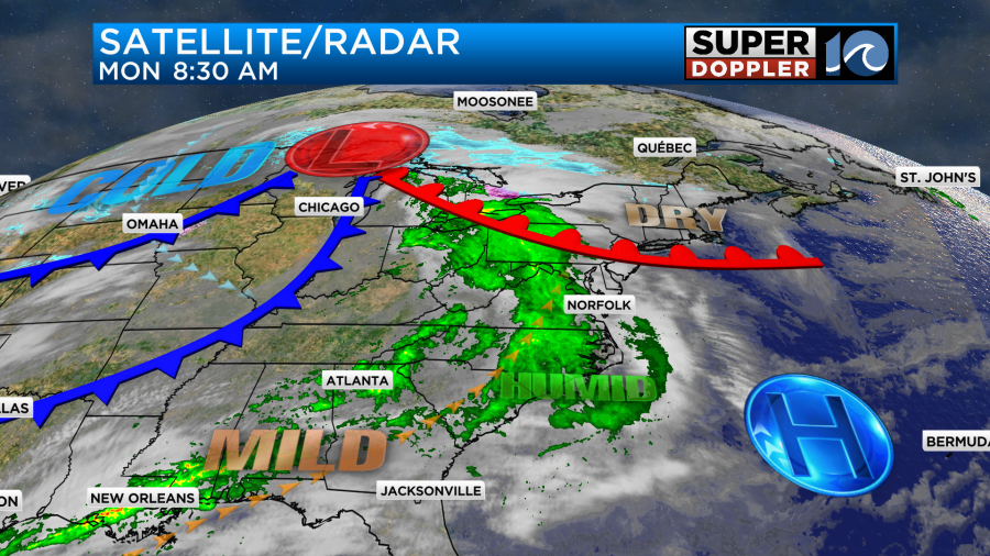
We have a southwest wind that will help to boost our temperatures, but it will also let some deeper moisture move into the area. High temps will make it to near 60 degrees this afternoon despite lots of clouds.
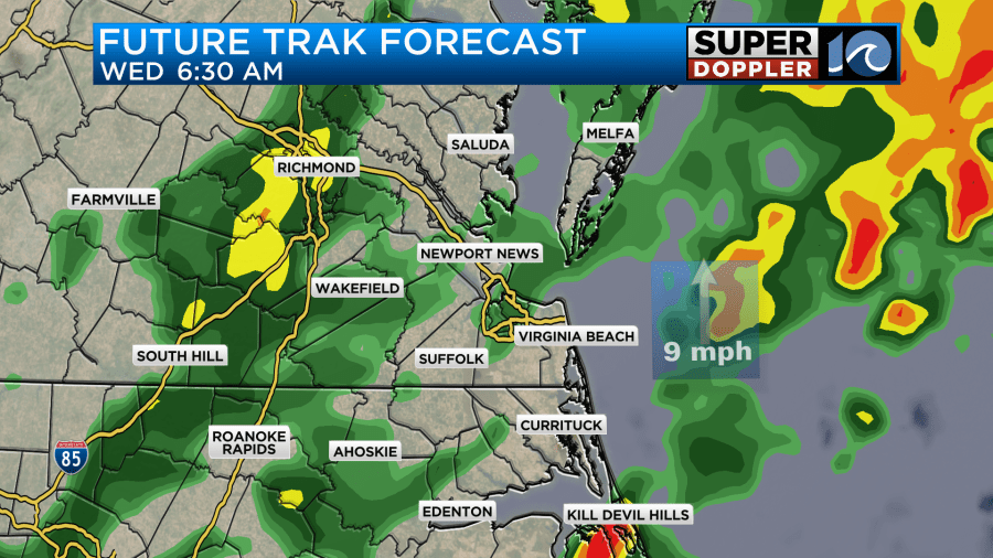
There were a few rain showers this morning in the area. Rain will increase for a time between the mid-morning and early-to-mid afternoon.
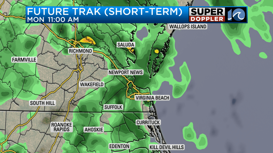
There will be a weak upper level disturbance swinging through during that time. It should move out by the afternoon. So our rain chances should drop off after about 2pm to 20%. That is basically “isolated”. Winds will be out of the southwest at 5-15mph.
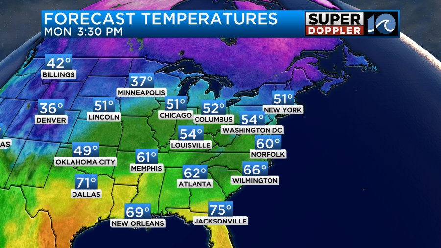
Tomorrow we’ll still be in the warm zone. There will be a lot of moisture, but there won’t be any big surface features other than high pressure offshore. This means that we’ll be mostly cloudy Tuesday with only a few spotty showers possible. There will be a decent amount of time to get outside and enjoy the milder temps. Highs will be in the mid 60s.
Winds will be light and out of the southwest.
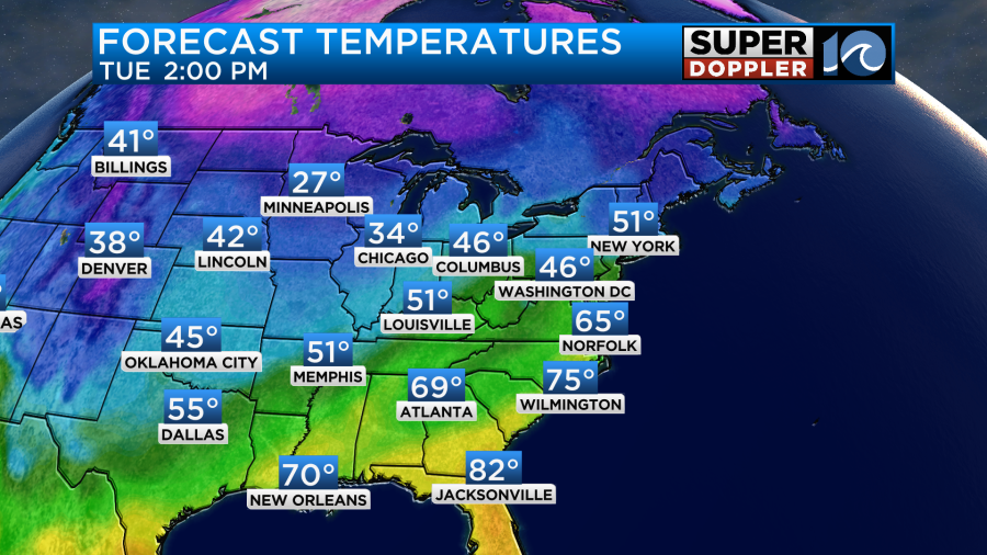
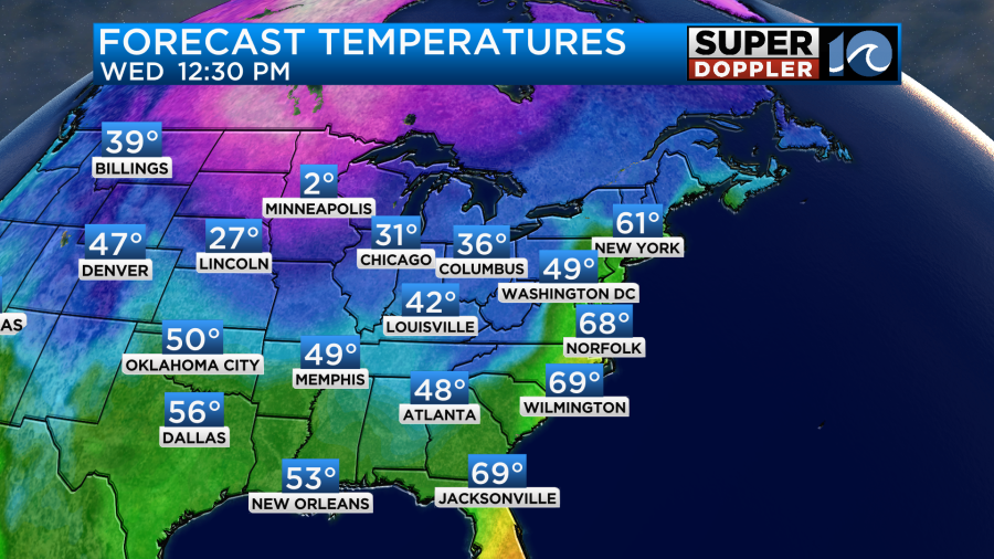
By Wednesday the deep moisture will pool into the Mid-Atlantic and Southeast. A large area of rain will form ahead of the 2 cold fronts. The fronts will actually combine into one feature which will add a little bit of a punch. Southwest winds will increase ahead of it. Temps will warm to the upper 60s.
We’ll have cloudy skies though through the day. There will be a round of showers in the morning.
Then the showers will turn into a big rain shield later in the day. There may even be a few thunderstorms
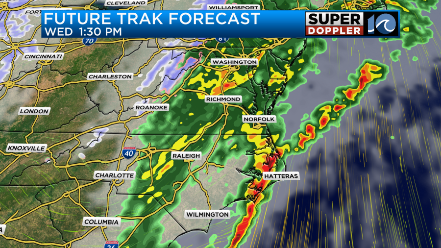
The front will swing through late Wednesday. We should clear out by the later evening. Temps will drop down to the 30s Wednesday night, but most temps should stay above freezing. However, the high temps on Thursday will only reach the mid 40s.
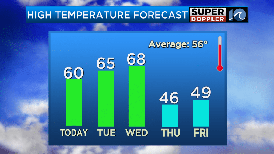
High temps will only be in the 40s Thursday and Friday despite a good amount of sunshine. Lows will be in the 30s Thursday morning but 20s and 30s Friday morning. We’ll warm up on Saturday to the 50s. For now the forecast looks dry.
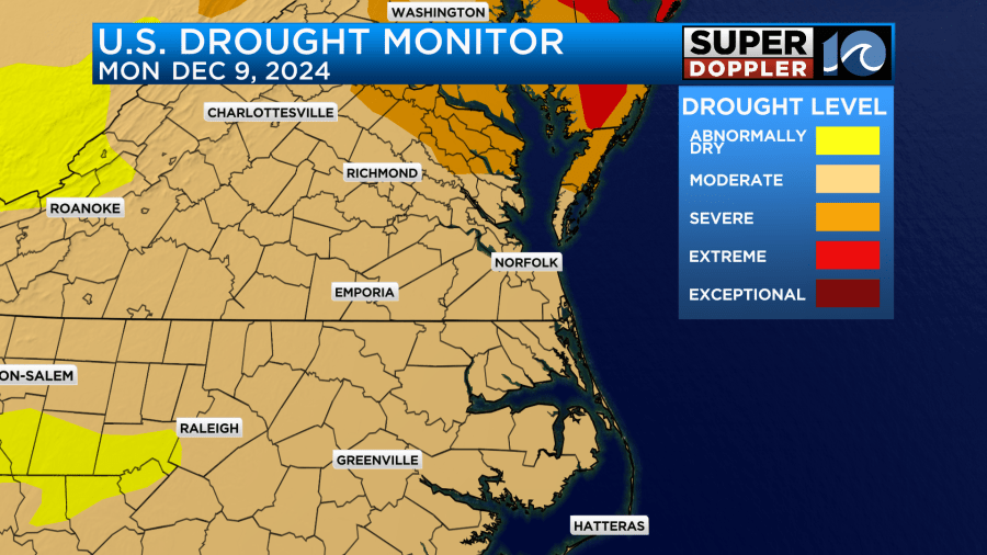
We definitely need some rain. At one point earlier this year we had a rainfall surplus of about 10 inches. After the dryness of the last few months we now have an annual deficit.

We have a moderate drought for much of the region with a severe drought over Accomack count and the Northern Neck.
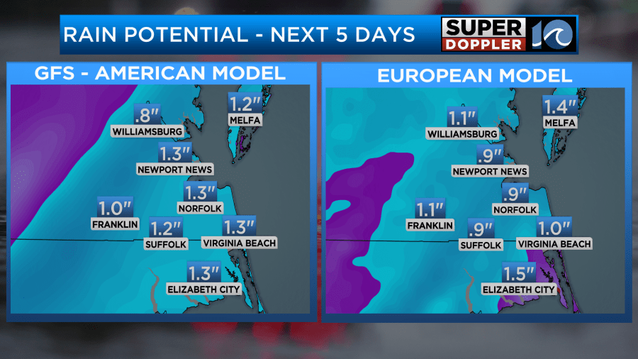
We may get about a tenth of an inch today, but we’ll probably receive about 1 to 1.5 inches on Wednesday.
We’ll have updates on the rain. Stay tuned.
Meteorologist: Jeremy Wheeler