This time of year our average high temperatures are in the upper 50s.
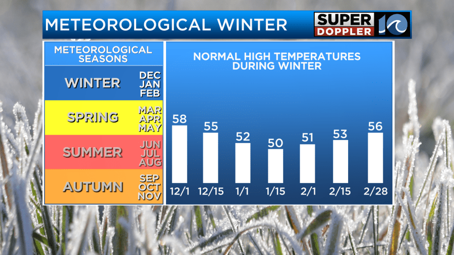
Meteorological Winter basically runs from December first through the end of February. This allows meteorologists to work with averages as the seasons are sectioned off into equal parts. It does get confusing though as actual Winter (on the calendar) doesn’t start until December 21st. The important thing with the above graphic though is the average high temps through the period. While the average is in the upper 50s, lately we have been in the 40s.
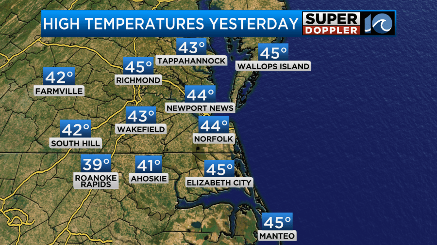
Yesterday we had high temps in the mid 40s as predicted.
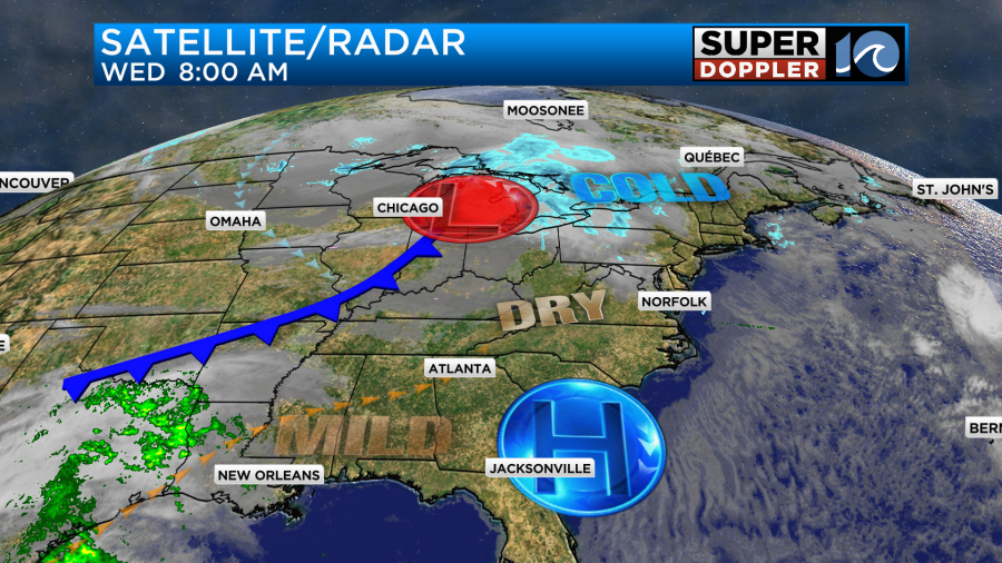
It was chilly and breezy again. It wasn’t too bad unless you were outside for a long time. Then this morning we had temps fall to the teens and 20s. Today we have high pressure in the region, but it is dropping to our south. This will allow the surface winds to pick up out of the southwest.
We’ll also have a lot of sunshine today. High temps will warm up slightly compared to yesterday. We’ll rise to the upper 40s to near 50 this afternoon.
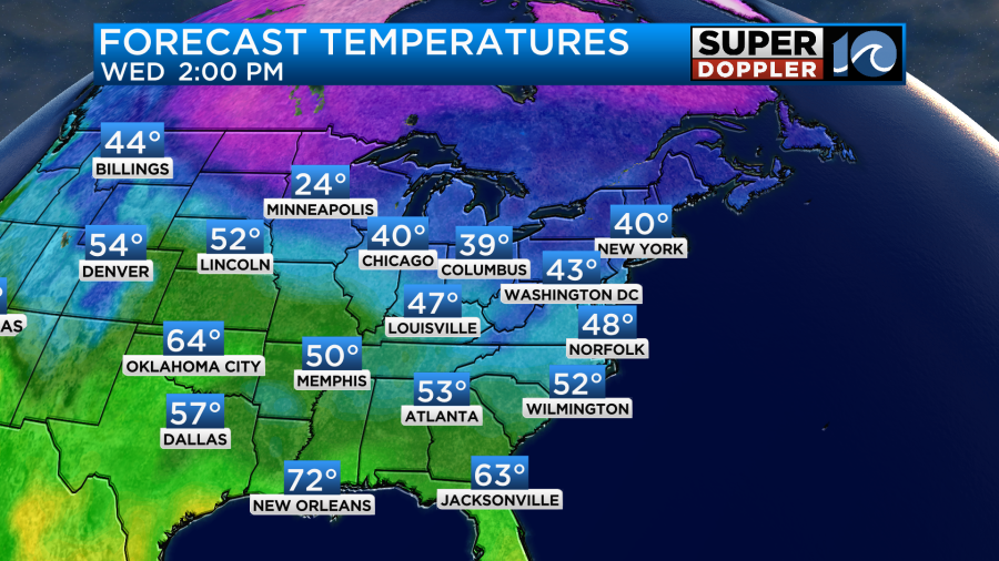
The wind will be out of the southwest at 10-15mph with some gusts to 20mph later this afternoon.
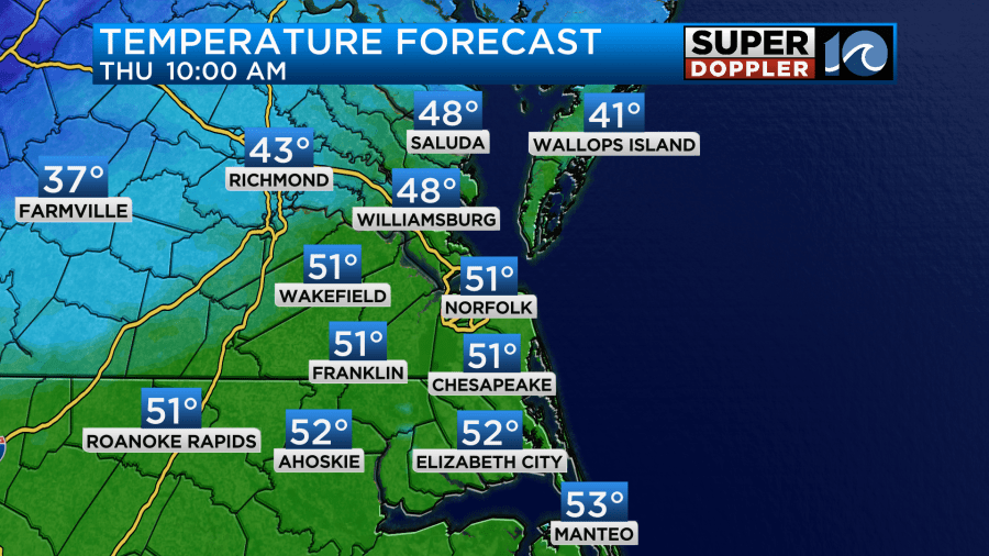
Tomorrow a strong and fast-moving cold front will swipe through the region. Before the front arrives in the morning temps will rise to the low 50s.
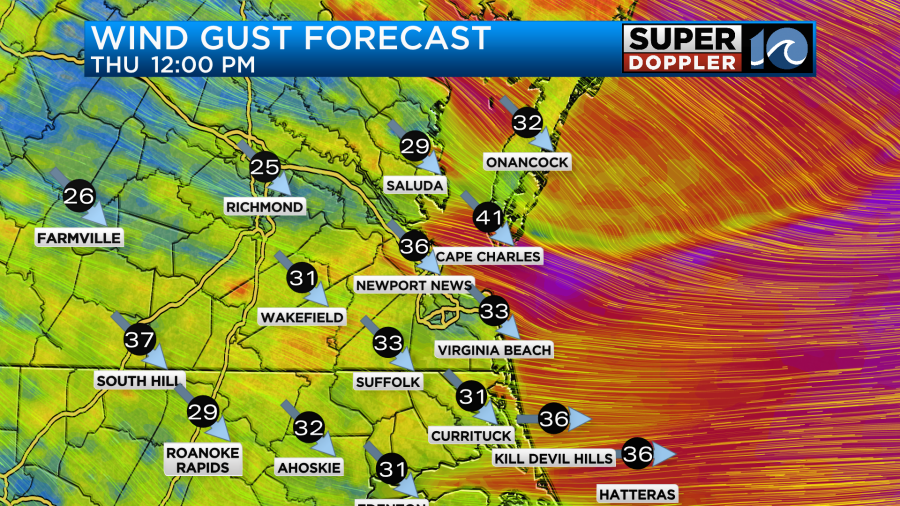
We’ll have a mix of sun and clouds during that time. There may be some isolated showers between then and1pm. Winds will run out of the southwest at 10-20mph with gusts to 25-30mph until about 11am. After the front swings through then the winds will turn out of the southwest. Winds will then gust up to 35mph.
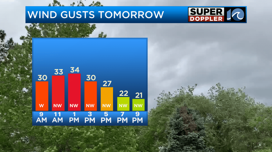
Winds will be strong through the afternoon. There may even be some gusts to 40mph on the Eastern Shore. Wind Advisories will be in effect for that time on the Eastern Shore.
Temps will fall from the low 50s to the low-mid 40s through the day.
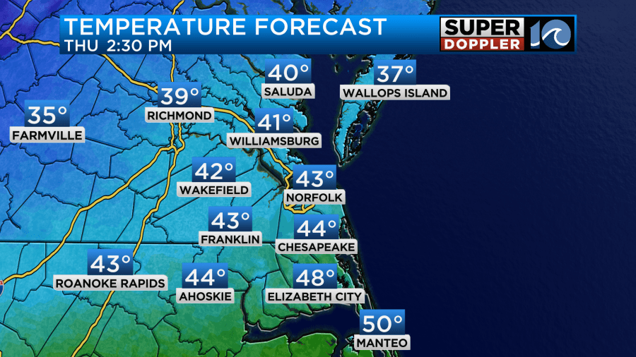
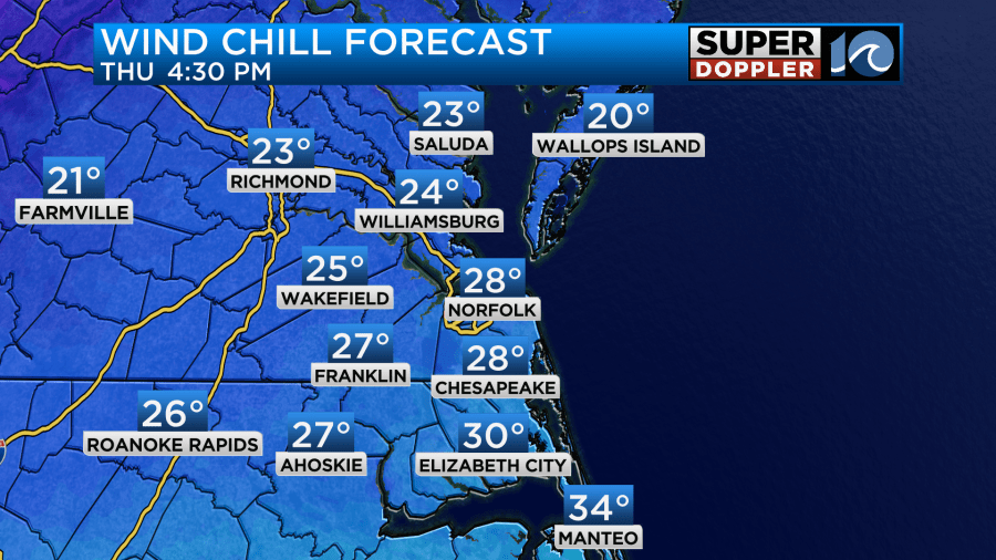
Wind chills will also drop. They will be in the 20s and 30s as we go from the mid-afternoon into the evening.
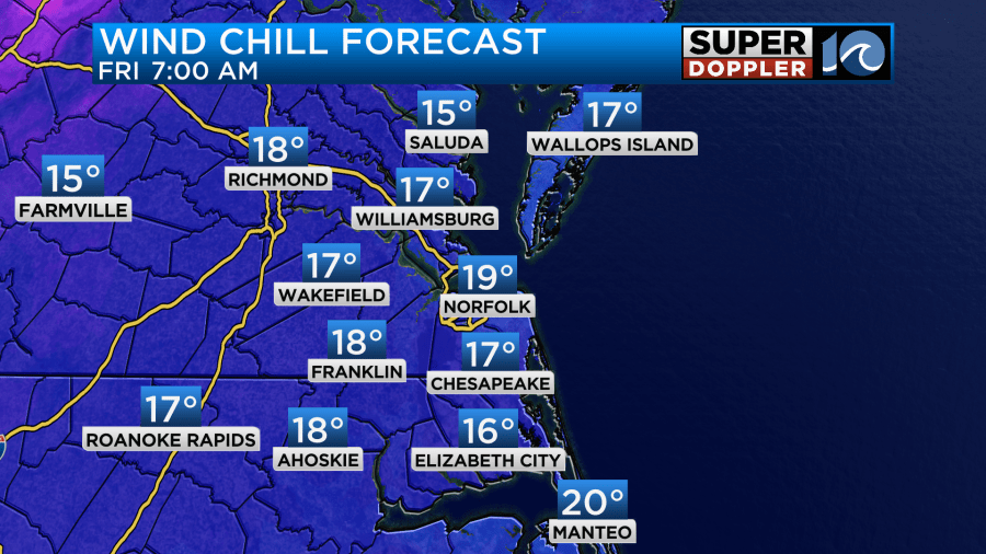
We’ll have clearing skies in the afternoon. Again, winds will be strong even into the evening. Winds will stay up from Thursday night into Friday morning. Skies will stay clear. Temps will drop down to the 20s. However… With the winds still up Friday morning that will put the wind chills in the teens area-wide.
We’ll have a lot of sunshine Friday, but temps will only rise up to the low 40s.
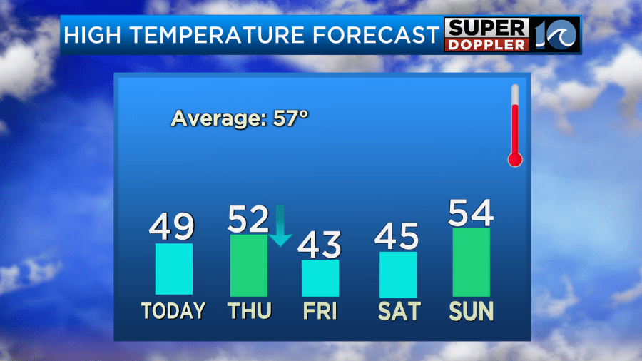
We’ll stay chilly on Saturday with low temps in the 20s and high temps in the 40s. There will be less wind though. We’ll have fair skies. We’ll be dry on Sunday. It should be nice as temps warm up a little bit. They will rise to the mid 50s. The precip that was going to happen over the weekend keeps getting pushed back. Now there may be a few showers late Monday, but it looks like it will be wetter on Tuesday. At least it will warm up to the 60s during that time. Next week definitely looks milder. Stay tuned for updates on all of this.
Meteorologist: Jeremy Wheeler